Worked example · Easy
Read a simple scale
A line on a plan measures 6 cm. The scale is 1 cm to 3 m. Find the real length.
Step 1: Every 1 cm means 3 m.
Step 2: \(6\times3=\boxed{18\text{ m}}\).
Work confidently with maps, scale plans and accurately measured three-figure bearings. Learn to convert lengths, construct routes and explain each step clearly.
Subtopic 1
A scale drawing keeps the same shape and proportions as a real object but shows it at a more convenient size. A map is a scale drawing of an area. You can measure the drawing to estimate real lengths or work backwards to draw accurately.
1 cm to 4 m: each 1 cm on the drawing represents 4 m in real life. A 3 cm line represents 12 m; a 20 m wall is 5 cm on the drawing.
2 cm to 5 km: each centimetre represents \(5\div2=2.5\) km.
1 : 500 means 1 unit on the drawing represents 500 of the same unit in real life. It can mean 1 cm to 500 cm = 5 m. Do not treat 1 : 500 as 1 cm to 500 m.
For conversion, first find what 1 cm on the drawing represents. Drawing to real: multiply; real to drawing: divide. For numerical ratios, make units match first.
A line on a plan measures 6 cm. The scale is 1 cm to 3 m. Find the real length.
Step 1: Every 1 cm means 3 m.
Step 2: \(6\times3=\boxed{18\text{ m}}\).
An actual fence is 35 m long. The scale is 1 cm to 5 m. How long is the fence on the plan?
Step 1: Each centimetre represents 5 m.
Step 2: \(35\div5=\boxed{7\text{ cm}}\) on the plan.
A map uses 2 cm to 5 km. Two villages are 8.4 cm apart on the map. Find their straight-line distance.
Step 1: \(1\text{ cm}\) represents \(5\div2=2.5\text{ km}\).
Step 2: \(8.4\times2.5=\boxed{21\text{ km}}\).
You may also see a ratio scale such as 1 : 250. Both sides refer to the same unit. Always convert the final answer into a practical unit if the question asks for metres or kilometres.
A plan is drawn to a scale of 1 : 250. A window is 18 mm wide on the plan. Find its actual width in metres.
Step 1: Actual width \(=18\times250=4500\text{ mm}\).
Step 2: \(4500\div1000=\boxed{4.5\text{ m}}\).
A room measures 12 m by 8 m. Draw its rectangular outline at 1 : 200.
Step 1: \(1\text{ cm}\) on the plan represents \(200\text{ cm}=2\text{ m}\).
Step 2: Plan length \(=12\div2=6\text{ cm}\); width \(=8\div2=4\text{ cm}\).
Step 3: Draw and label a rectangle \(\boxed{6\text{ cm by }4\text{ cm}}\).
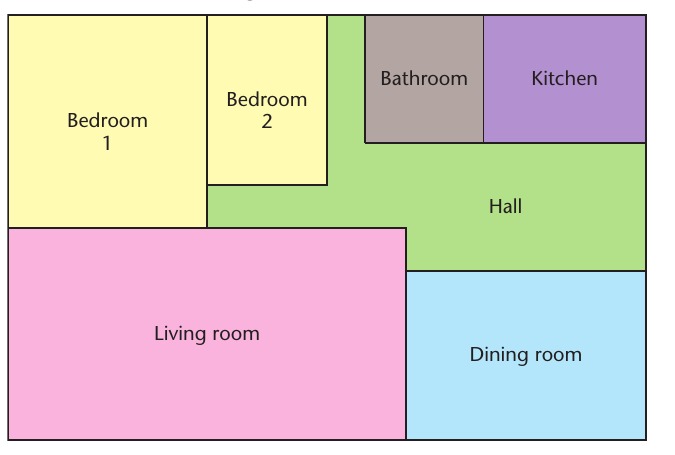
At a scale of 1 cm to 2 m, a rectangular kitchen is 2.8 cm by 1.6 cm on the plan. Find the kitchen dimensions and actual floor area.
Step 1: Actual length \(=2.8\times2=5.6\text{ m}\); width \(=1.6\times2=3.2\text{ m}\).
Step 2: Actual area \(=5.6\times3.2=\boxed{17.92\text{ m}^2}\).
A map scale is 1 : 50 000. Two points are 7.6 cm apart. Find the ground distance in kilometres.
Step 1: \(7.6\times50\,000=380\,000\text{ cm}\).
Step 2: \(380\,000\text{ cm}=3800\text{ m}=\boxed{3.8\text{ km}}\).
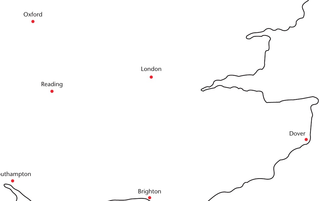
On a scale map, two towns are 5.5 cm apart in a straight line. If 1 cm represents 18 km, what distance separates them?
Step 1: Ground distance \(=5.5\times18\).
Step 2: \(\boxed{99\text{ km}}\). This is straight-line distance, not necessarily the driving distance.
A map scale is 3 cm to 8 km. How long must the line be to represent 60 km?
Step 1: Find the drawing length for 1 km: \(3\div8\) cm.
Step 2: For 60 km, \(60\times3\div8=\boxed{22.5\text{ cm}}\).
A site plan is at 1 : 1250. A path is shown as 5.6 cm long. Another real path is 40 m long. Find (a) the actual length of the first path, (b) the plan length of the second path.
Step 1: (a) \(5.6\times1250=7000\text{ cm}=\boxed{70\text{ m}}\).
Step 2: (b) \(40\text{ m}=4000\text{ cm}\).
Step 3: Plan length \(=4000\div1250=\boxed{3.2\text{ cm}}\).
A journey follows two straight sections measuring 4.5 cm and 3.8 cm on a map. The scale is 1 cm to 12 km. Find the total length of the two sections and explain why this is not the straight-line distance between start and finish.
Step 1: Add the two route sections: \(4.5+3.8=8.3\text{ cm}\).
Step 2: \(8.3\times12=\boxed{99.6\text{ km}}\).
Step 3: This total follows both route legs; the direct start-to-finish line may be shorter.
A rectangular sports ground measures 96 m by 64 m. A drawing must fit within 16 cm by 12 cm. Will the scale 1 cm to 8 m work? Give the drawn dimensions.
Step 1: Length: \(96\div8=12\text{ cm}\). Width: \(64\div8=8\text{ cm}\).
Step 2: \(12\leq16\) and \(8\leq12\), so the drawing \(\boxed{\text{fits}}\).
Step 3: Draw a rectangle \(\boxed{12\text{ cm by }8\text{ cm}}\).
Subtopic 2
A bearing tells you a direction from one point to another. It is measured clockwise from north, starting at the point named after the word from. Every bearing has three digits, including any zeros at the beginning.
Due north = \(000^\circ\); east = \(090^\circ\); south = \(180^\circ\); west = \(270^\circ\).
Write \(7^\circ\) as 007° and \(65^\circ\) as 065°. A full turn \(360^\circ\) points north again, normally recorded as 000°.
For a reverse bearing, add \(180^\circ\) if the original bearing is less than \(180^\circ\); otherwise subtract \(180^\circ\). The result is always in the range 000°–359°.
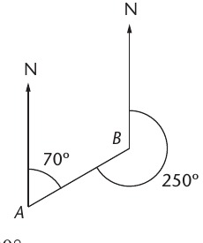
A ray points 43° clockwise from north. Write the three-figure bearing.
Step 1: Bearings have exactly three figures.
Step 2: \(43^\circ\) is written as \(\boxed{043^\circ}\).
Write the bearings for (a) north-east, (b) due south, (c) due west.
Step 1: NE lies 45° clockwise from north: \(\boxed{045^\circ}\).
Step 2: Due south is \(\boxed{180^\circ}\); due west is \(\boxed{270^\circ}\).
The bearing of B from A is 062°. Find the bearing of A from B.
Step 1: Opposite directions differ by 180°.
Step 2: \(062^\circ+180^\circ=\boxed{242^\circ}\).
The bearing of C from D is 230°. Find the bearing of D from C.
Step 1: Since \(230^\circ\) is greater than \(180^\circ\), subtract 180°.
Step 2: \(230^\circ-180^\circ=\boxed{050^\circ}\).
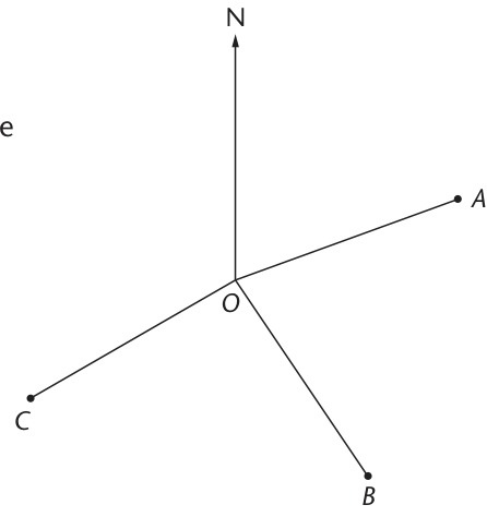
A point P lies south-east of O, with ray OP making 35° south of east. Find the bearing of P from O.
Step 1: East is \(090^\circ\). Turn a further 35° clockwise towards south.
Step 2: Bearing \(=090^\circ+35^\circ=\boxed{125^\circ}\).
A point Q is on a bearing 298° from P. Find the bearing of P from Q.
Step 1: We need the opposite direction, not the bearing from P again.
Step 2: \(298^\circ-180^\circ=\boxed{118^\circ}\).
Always draw a fresh north line at each new starting point in a multi-leg journey.
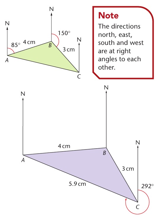
B is 15 km from A on a bearing of 055°. Use a scale of 1 cm to 5 km. State exactly how to plot B.
Step 1: Convert: \(15\div5=3\text{ cm}\).
Step 2: At A, draw north. Measure 55° clockwise from north and draw a ray.
Step 3: Mark B \(\boxed{3\text{ cm}}\) along the ray, and label the bearing \(055^\circ\).
A boat sails 18 km on a bearing of 130°. The plan scale is 1 cm to 3 km. What length and direction should be drawn?
Step 1: Drawing length \(=18\div3=\boxed{6\text{ cm}}\).
Step 2: Measure \(\boxed{130^\circ}\) clockwise from north at the starting point and draw a 6 cm line.
A path runs 20° north of west. Find its three-figure bearing.
Step 1: West is \(270^\circ\). Moving 20° towards north increases the bearing.
Step 2: \(270^\circ+20^\circ=\boxed{290^\circ}\).
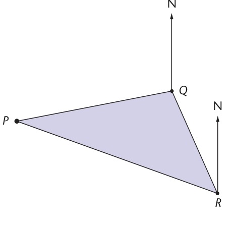
A goes 8 km due east to B, then 6 km due south to C. Use a scale of 1 cm to 2 km. Find the straight-line distance AC and the bearing of C from A from your drawing.
Step 1: Draw AB = \(8\div2=4\text{ cm}\) east and BC = \(6\div2=3\text{ cm}\) south.
Step 2: Measure AC on the accurate drawing: \(5\text{ cm}\). Convert: \(5\times2=\boxed{10\text{ km}}\).
Step 3: At A, measure clockwise from north to AC: approximately \(\boxed{127^\circ}\). A small variation is acceptable from an accurately drawn diagram.
From A to B the bearing is 060° and the distance is 16 km. From B to C the bearing is 150° and the distance is 12 km. Use 1 cm to 4 km. Find AC.
Step 1: Draw AB \(=16\div4=4\text{ cm}\) on bearing 060°.
Step 2: At B draw BC \(=12\div4=3\text{ cm}\) on bearing 150°. The legs meet at 90° because \(150-60=90\).
Step 3: Measure AC \(\approx5\text{ cm}\), so \(AC\approx5\times4=\boxed{20\text{ km}}\).
A campsite lies 22 km from a starting point on a bearing of 285°. State the return bearing and the two drawing lengths if the scale is 1 cm to 5.5 km.
Step 1: Reverse bearing \(=285-180=\boxed{105^\circ}\).
Step 2: Each leg is \(22\div5.5=\boxed{4\text{ cm}}\) long on the plan.
Step 3: Draw the return bearing from the campsite, not the starting point.
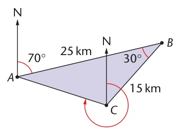
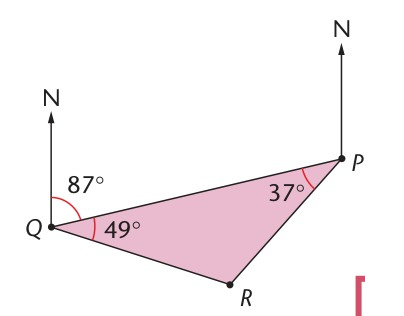
A navigation diagram requires points B and C: B is 18 km from A on 085°; C is 12 km from B on 150°. The scale is 1 cm to 3 km. State the two line lengths and the correct north-line positions.
Step 1: \(AB=18\div3=\boxed{6\text{ cm}}\); \(BC=12\div3=\boxed{4\text{ cm}}\).
Step 2: At A draw a north line, then 085° clockwise, and measure 6 cm to B.
Step 3: At B draw a second north line parallel to the first; measure 150° clockwise and mark C 4 cm along that ray.
Step 4: To find AC and the bearing of A from C, measure them on your completed accurate plan.
Try each question on paper before opening its Show Answer toggle. Early questions build confidence; the final questions require multi-step reasoning, construction descriptions and careful units. All questions are original exam-style practice, not copied past-paper questions.
A: Questions 1–22, scale drawings and maps. B: Questions 23–44, bearings and combined plans.
A line is 4 cm on a drawing. Scale: 1 cm to 6 m. Find the real length.
Step 1: \(1\text{ cm}\to6\text{ m}\).
Step 2: \(4\times6=\boxed{24\text{ m}}\)
A wall is 28 m long. Scale: 1 cm to 7 m. Find the drawn length.
Step 1: Every centimetre represents 7 metres.
Step 2: \(28\div7=\boxed{4\text{ cm}}\)
A map has scale 2 cm to 12 km. How far is a 5 cm map line?
Step 1: One centimetre represents \(12\div2=6\) km.
Step 2: \(5\times6=\boxed{30\text{ km}}\)
On a scale diagram, 1 cm represents 4 m. A road measures 45 mm. Find its real length.
Step 1: \(45\text{ mm}=4.5\text{ cm}\).
Step 2: \(4.5\times4=\boxed{18\text{ m}}\)
A model is drawn at 1 : 100. A measured length is 9 cm. Find the actual length in metres.
Step 1: Actual length \(=9\times100=900\text{ cm}\).
Step 2: \(900\div100=\boxed{9\text{ m}}\)
A strip is 18 m long. On a plan 1 cm represents 3 m. How long is the strip on the plan?
Step 1: \(18\div3=\boxed{6\text{ cm}}\)
Two villages are 3.4 cm apart. The scale is 1 cm to 25 km. Calculate their straight-line separation.
Step 1: \(3.4\times25=\boxed{85\text{ km}}\)
Scale 1 : 500. A line is 2.6 cm on the plan. Find its actual length in metres.
Step 1: \(2.6\times500=1300\text{ cm}\).
Step 2: \(1300\div100=\boxed{13\text{ m}}\)
Draw a line to represent 30 km using a scale 1 cm to 5 km. How long is your drawn line?
Step 1: \(30\div5=\boxed{6\text{ cm}}\).
Step 2: Use a ruler to draw and label a 6 cm line.
The scale is 3 cm to 24 km. A pair of points is 7.5 cm apart. Find their real separation.
Step 1: \(1\text{ cm}\to24\div3=8\) km.
Step 2: \(7.5\times8=\boxed{60\text{ km}}\)
A real distance is 42 km; the map scale is 2 cm to 7 km. Find the map distance.
Step 1: For 7 km draw 2 cm.
Step 2: \(42\div7\times2=\boxed{12\text{ cm}}\)
A court measures 36 m by 24 m. The plan scale is 1 cm to 6 m. Find both planned dimensions.
Step 1: Length \(36\div6=\boxed{6\text{ cm}}\).
Step 2: Width \(24\div6=\boxed{4\text{ cm}}\)
A field 150 m by 90 m is to be drawn to scale 1 : 3000. Find the drawn dimensions.
Step 1: \(150\text{ m}=15\,000\text{ cm}\) and \(90\text{ m}=9000\text{ cm}\).
Step 2: Divide by 3000: \(\boxed{5\text{ cm by }3\text{ cm}}\)
A 40 m building is drawn as an 8 cm line. Express the scale as 1 cm to ? m.
Step 1: \(40\div8=5\).
Step 2: Scale \(\boxed{1\text{ cm to }5\text{ m}}\)
A map is at 1 : 20 000. A route is shown as 15 cm. Find the ground length in kilometres.
Step 1: \(15\times20\,000=300\,000\text{ cm}\).
Step 2: \(300\,000\div100\,000=\boxed{3\text{ km}}\)
A map is 1 : 10 000. Two sites are 750 m apart. How many centimetres apart should they appear?
Step 1: \(750\text{ m}=75\,000\text{ cm}\).
Step 2: \(75\,000\div10\,000=\boxed{7.5\text{ cm}}\)
Map A has scale 1 cm to 4 km and map B has scale 1 cm to 10 km. Find the length representing the same 60 km route on each.
Step 1: On A: \(60\div4=\boxed{15\text{ cm}}\).
Step 2: On B: \(60\div10=\boxed{6\text{ cm}}\).
Step 3: Smaller ground distance per cm means a longer drawing for the same route.
A room measures 5 cm by 3 cm on a plan at 1 cm to 2 m. Find the real floor area.
Step 1: Real dimensions \(10\text{ m}\) by \(6\text{ m}\).
Step 2: Area \(10\times6=\boxed{60\text{ m}^2}\)
A walking trail on a map follows sections 2.5 cm and 4.8 cm. Scale: 1 cm to 2 km. Find the total distance travelled.
Step 1: Sum the measured route: \(2.5+4.8=7.3\text{ cm}\).
Step 2: \(7.3\times2=\boxed{14.6\text{ km}}\)
A park is 210 m long and 120 m wide. An A4 plan has 18 cm of usable width and 14 cm of usable height. Can the scale 1 cm to 15 m fit the park on it?
Step 1: Drawing dimensions \(210\div15=14\text{ cm}\) and \(120\div15=8\text{ cm}\).
Step 2: Both fit within 18 cm by 14 cm, so \(\boxed{\text{yes}}\).
A scale model shows three consecutive walls of 5.2 cm, 3.4 cm and 1.9 cm. At 1 : 400, find their total real length in metres.
Step 1: Total drawing length \(5.2+3.4+1.9=10.5\text{ cm}\).
Step 2: \(10.5\times400=4200\text{ cm}\).
Step 3: \(4200\div100=\boxed{42\text{ m}}\)
On a 1 : 250 map, a rectangular courtyard has actual perimeter 38 m and length 12 m. Find the width to draw, in centimetres.
Step 1: Actual width \(=38\div2-12=7\text{ m}\).
Step 2: \(7\text{ m}=700\text{ cm}\).
Step 3: On plan \(700\div250=\boxed{2.8\text{ cm}}\)
Write 6° clockwise from north as a three-figure bearing.
Step 1: Add leading zeros to three digits: \(\boxed{006^\circ}\)
What is the three-figure bearing of due east?
Step 1: Clockwise from north to east is 90°: \(\boxed{090^\circ}\)
What bearing represents south-west exactly halfway between south and west?
Step 1: South is 180°, west is 270°.
Step 2: Halfway: \(180+45=\boxed{225^\circ}\)
B is on a bearing 065° from A. Find the bearing of A from B.
Step 1: \(065^\circ+180^\circ=\boxed{245^\circ}\)
C is on a bearing 240° from D. Find the bearing of D from C.
Step 1: \(240^\circ-180^\circ=\boxed{060^\circ}\)
Town R is due south of town S. State the bearing of R from S and S from R.
Step 1: R from S: \(\boxed{180^\circ}\).
Step 2: S from R: \(\boxed{000^\circ}\)
Find the three-figure bearing corresponding to south-east.
Step 1: South-east is halfway between east (90°) and south (180°).
Step 2: \(90+45=\boxed{135^\circ}\)
The direction is 25° west of north. Find its clockwise bearing.
Step 1: Turn anticlockwise 25°, equivalent to clockwise \(360-25\).
Step 2: Bearing \(=\boxed{335^\circ}\)
A ship sails on a bearing of 318°. How many degrees west of north is this?
Step 1: \(360-318=\boxed{42^\circ}\) west of north
The bearing of K from L is 350°. Find the reverse bearing.
Step 1: \(350-180=\boxed{170^\circ}\)
Plot B 20 km from A on a bearing 070°, scale 1 cm to 5 km. How many centimetres should AB measure?
Step 1: \(20\div5=\boxed{4\text{ cm}}\).
Step 2: Draw north at A; measure clockwise 70°; mark B 4 cm along the ray.
From a point O, plot P at 040° and Q at 210°. Each point is 4 cm from O. Describe the construction.
Step 1: Draw one north arrow at O.
Step 2: Measure 40° clockwise and mark P 4 cm away.
Step 3: Measure 210° clockwise from the same north line and mark Q 4 cm away.
A village lies 28° north of east from a farm. Find its bearing from the farm.
Step 1: East = 090°; toward north subtract 28°.
Step 2: \(90-28=\boxed{062^\circ}\)
P is on bearing 302° from Q. Find the bearing of Q from P.
Step 1: \(302-180=\boxed{122^\circ}\)
A boat sails 36 km on bearing 125°. On a scale 1 cm to 6 km, give the length of the line and instructions for drawing it.
Step 1: \(36\div6=\boxed{6\text{ cm}}\).
Step 2: Draw a north line at the port, measure 125° clockwise, and mark the boat 6 cm along that ray.
An aircraft flies 45 km on bearing 040°. State its direct return bearing and the return line length at 1 cm to 9 km.
Step 1: Reverse \(=040+180=\boxed{220^\circ}\).
Step 2: Drawing length \(45\div9=\boxed{5\text{ cm}}\)
On an accurately constructed map at 1 cm to 3 km, the line joining two points measures 7.4 cm. Find the ground distance.
Step 1: \(7.4\times3=\boxed{22.2\text{ km}}\)
On a diagram, the bearing of T from S is 178°. Find the bearing of S from T. Explain why 358° is correct.
Step 1: \(178+180=\boxed{358^\circ}\).
Step 2: The reversed ray points just west of north, consistent with a 358° bearing.
A walks 10 km due east to B then 24 km due south to C. Give the lengths AB and BC for a plan at 1 cm to 2 km.
Step 1: \(AB=10\div2=\boxed{5\text{ cm}}\).
Step 2: \(BC=24\div2=\boxed{12\text{ cm}}\).
Step 3: Bearings: 090° then 180° measured at their respective starting points.
Using the journey in Question 41, find the straight-line distance from A to C, and estimate the bearing of C from A.
Step 1: At scale 1 cm to 2 km draw 5 cm east followed by 12 cm south.
Step 2: Direct AC on the drawing is \(13\text{ cm}\); hence \(13\times2=\boxed{26\text{ km}}\).
Step 3: From A, AC is south-east, about \(\boxed{157^\circ}\) clockwise from north (measured).
A is at O. B lies 12 km on 025° from O, and C lies 12 km on 115° from O. Use 1 cm to 4 km. Find OB and OC on the drawing and explain what angle BOC is.
Step 1: \(OB=OC=12\div4=\boxed{3\text{ cm}}\).
Step 2: At O draw bearings 025° and 115°.
Step 3: Angle \(BOC=115-25=\boxed{90^\circ}\).
From P travel 16 km on bearing 065° to Q. From Q travel 12 km on bearing 155° to R. For a 1 cm to 4 km scale, write exact construction instructions and find PR.
Step 1: Draw PQ \(=16\div4=4\text{ cm}\) along 065° from north at P.
Step 2: At Q draw a fresh north line and QR \(=12\div4=3\text{ cm}\) along 155°.
Step 3: The legs meet at 90° (155°−65°=90°), so a correct drawing gives PR ≈ 5 cm.
Step 4: \(PR\approx5\times4=\boxed{20\text{ km}}\)